

Adopting an Official Map
Posted October 18, 2022
In terms of planning, maps are pretty important. There are maps to identify land use and utilities, maps for trails and roadways, maps showing natural resources, maps of preserved land, and the list goes on. There's even an "Official Map" which often includes these features and can be adopted by a municipality to better plan for future growth. Official Maps are a unique and effective planning tool for implementing municipal goals, and should not be confused with the zoning map, the future land use map, or the municipal road map.
Official Maps can serve as a useful tool by effectively prioritizing a municipality's acquisition needs and allowing them to focus on what's important to the community. While they do not constitute an active acquisition of property rights, they provide the opportunity for a municipality to reserve important lands for potential acquisition within a one-year timeframe. Municipal maps can also inform property owners and developers of the community’s long-range goals and intentions.
In addition to long-range planning and future growth, official maps can support a municipality's chance to receive funding as the map demonstrates that they have a plan, as well as the technical means to implement it.
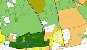
Chester County municipalities are among the most active users of this planning tool in Pennsylvania, with over two dozen adopted Official Maps. Examples of official maps in Chester County include East Bradford's, which has helped preserve open space, direct growth, and identify trail corridors; East Fallowfield's, which focuses on proposed trails; New Garden's, which shows land to be preserved, future trails, and a future road alignment; and West Whiteland's, which addresses a wide range of municipal and public needs such as sidewalks.
Learn more about official maps, including how to get started, considerations, and resource links.
CCPC's planning eTools are intended to be user-friendly, providing a quick overview of each topic, an explanation of how it works, and considerations for addressing the topic within a community. Topic categories include agriculture; community health; economic development; environment; historic preservation; housing; land use; open space; transportation; utilities, infrastructure & energy. View the full list of eTools.